Locory Every place has a story.
Login Sign Up
My Account
Open Map Create a Locory My Locories Featured Regions Leaderboard About What is a Locory? Collaboration Blog Feedback
Login Sign Up
My Account
  1. Home
  2. Almaden Quicksilver Mining District (Casa Grande)
Locory page

Almaden Quicksilver Mining District (Casa Grande)

By Seeker 6mo ago
See on map
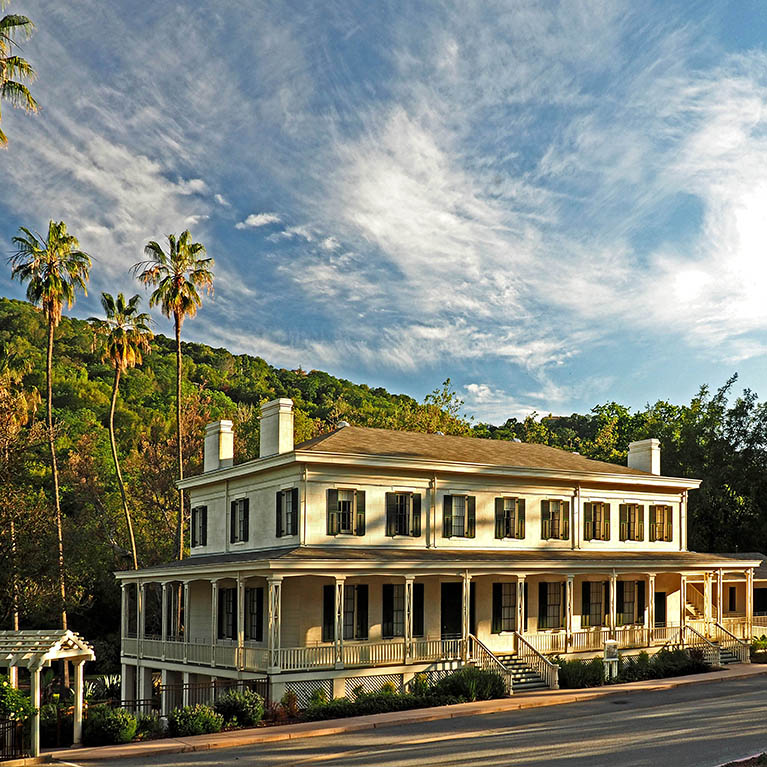
Almaden Quicksilver Mining District (Casa Grande) photo 1
Almaden Quicksilver Mining District (Casa Grande) photo 2
The Almaden Quicksilver Mining Museum (Casa Grande) interprets New Almaden, a 19th-century mercury (quicksilver) mining district that was one of California's earliest and most productive mines. The site preserves mining-era infrastructure including the Casa Grande building, remnants of furnaces and stamp mills, and mine shaft locations within Almaden Quicksilver County Park. The museum and park document the industrial and community infrastructure that supported mining operations in the region.
Tags
Local Community Old Infrastructure
Location
37.178429, -121.819441
Views
1

Comments

0
Be the first to comment!
Share
S
Locory name
Location details
Link to share
Link copied to clipboard
Report Locory
Locory

Discover, share, and explore community-driven points of interest with Locory.

Follow Us

About Contact Documentation Collaboration Upcoming Privacy Policy Terms of Service Accessibility Mailing List Wiki