Locory page
Port-au-Prince
By Seeker
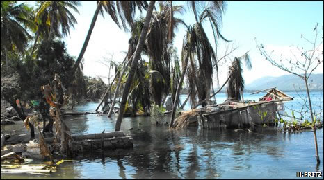
According to official estimates, 222,570 people killed, 300,000 injured, 1.3 million displaced, 97,294 houses destroyed and 188,383 damaged in the Port-au-Prince area and in much of southern Haiti. This includes at least 4 people killed by a local tsunami in the Petit Paradis area near Leogane. Uplift was observed along the coast from Leogane to L'Acul and subsidence was observed along the coast from Grand Trou to Port Royal. Felt (VII) at Port-au-Prince and Petionville and (V) at Vieux Bourg d'Aquin and Port-de-Paix. Felt (V) at La Vega, Moca and San Cristobal; (IV) at Puerto Plata, Santiago, Santo Domingo and Sosua, Dominican Republic. Felt throughout Haiti and the Dominican Republic. Felt (III) at Oranjestad, Aruba; (IV) at Santiago de Cuba and (III) at Guantanamo, Cuba; (II) in the Kingston-Mona area, Jamaica; (III) at Cockburn Harbour and (II) at Cockburn Town, Turks and Caicos Islands; (II) at Caracas, Venezuela. Felt in parts of The Bahamas, Puerto Rico and the US Virgin Islands and as far as southern Florida, northern Colombia and northwestern Venezuela.
Tags
Be the first to comment!