Locory Every place has a story.
Login Sign Up
My Account
Open Map Create a Locory My Locories Featured Regions Leaderboard About What is a Locory? Collaboration Blog Feedback
Login Sign Up
My Account
  1. Home
  2. Izmit (Kocaeli)
Locory page

Izmit (Kocaeli)

By Seeker 6mo ago
See on map
Izmit (Kocaeli) photo 1
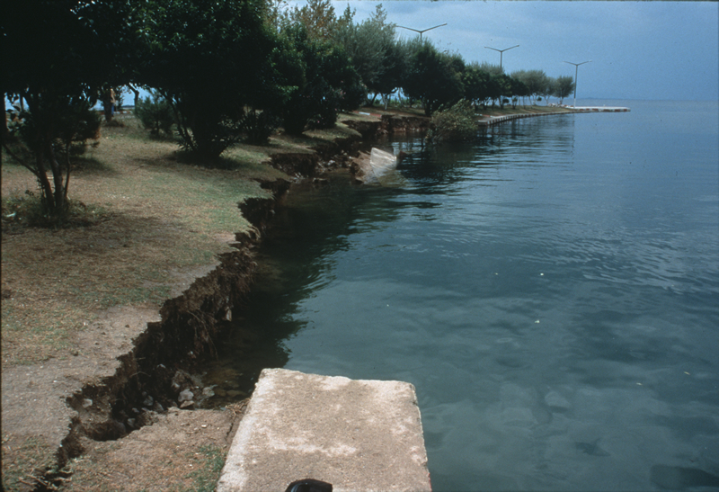
On August 17, 1999, at 3:02 am local time (00:02 GMT) a magnitude (Mw) 7.4 earthquake occurred on the northern Anatolian fault. The epicenter was located very close to the south shore of the Bay of Izmit, an eastward extension of the Marmara Sea. The location of this earthquake and its proximity to a populous region on the Bay of Izmit contributed greatly to its damaging effects. The total estimated loss for port facilities in the region was around $200 million (US). Subsidence and slumping caused much of the coastal damage, but a tsunami was generated that also caused coastal damage and deaths.
Tags
Art / Graffiti Local Community Battles Dams
Event Date
August 17, 1999
Location
40.748000, 29.864000
Views
1

Comments

0
Be the first to comment!
Share
S
Locory name
Location details
Link to share
Link copied to clipboard
Report Locory
Locory

Discover, share, and explore community-driven points of interest with Locory.

Follow Us

About Contact Documentation Collaboration Upcoming Privacy Policy Terms of Service Accessibility Mailing List Wiki