Locory Every place has a story.
Login Sign Up
My Account
Open Map Create a Locory My Locories Featured Regions Leaderboard About What is a Locory? Collaboration Blog Feedback
Login Sign Up
My Account
  1. Home
  2. Leninakan-Spitak-Kirovakan
Locory page

Leninakan-Spitak-Kirovakan

By Seeker 6mo ago
See on map
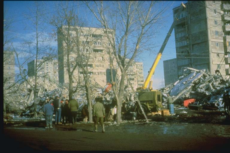
Leninakan-Spitak-Kirovakan photo 1
The magnitude 6.9 earthquake shook northwestern Armenia, and was followed four minutes later by a magnitude 5.8 aftershock. The earthquakes affected an area 80 kilometers in diameter. This set includes damage photographs taken in and around the devastated cities of Spitak and Leninakan, where 25,000 deaths occurred. Location: Northwestern Armenian SSR, 18 kilometers north northwest of Spitak. Damage: $14.2 billion. Fifteen thousand were injured and 517,000 lost their homes. The death toll (25,000) could have been much worse had it not been for the heroic rescue of 15,000 who were pulled from the rubble.
Tags
Art / Graffiti Dams
Event Date
December 7, 1988
Location
40.987000, 44.185000
Views
1

Comments

0
Be the first to comment!
Share
S
Locory name
Location details
Link to share
Link copied to clipboard
Report Locory
Locory

Discover, share, and explore community-driven points of interest with Locory.

Follow Us

About Contact Documentation Collaboration Upcoming Privacy Policy Terms of Service Accessibility Mailing List Wiki