Locory Every place has a story.
Login Sign Up
My Account
Open Map Create a Locory My Locories Featured Regions Leaderboard About What is a Locory? Collaboration Blog Feedback
Login Sign Up
My Account
  1. Home
  2. Boston Water and Sewer Commission combined sewer system and outfall mapping
Locory page

Boston Water and Sewer Commission combined sewer system and outfall mapping

By Seeker 6mo ago
See on map
Boston Water and Sewer Commission combined sewer system and outfall mapping photo 1
Boston Water and Sewer Commission combined sewer system and outfall mapping photo 2
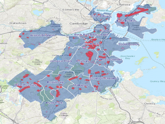
The Boston Water and Sewer Commission (BWSC) operates the city's water and sewer infrastructure including sections of combined sewer that convey both sanitary flow and stormwater. BWSC publishes maps and inventories of catch basins, storm drains, and combined sewer overflow (CSO) outfalls that discharge to the Charles River and Boston Harbor. BWSC maintains and repairs catch basins and storm drains and coordinates emergency responses to storm-related flooding.
Tags
Maps & Surveying Storm Drains Missions Old Infrastructure
Location
42.332373, -71.077850
Views
0

Comments

0
Be the first to comment!
Share
S
Locory name
Location details
Link to share
Link copied to clipboard
Report Locory
Locory

Discover, share, and explore community-driven points of interest with Locory.

Follow Us

About Contact Documentation Collaboration Upcoming Privacy Policy Terms of Service Accessibility Mailing List Wiki