Locory Every place has a story.
Login Sign Up
My Account
Open Map Create a Locory My Locories Featured Regions Leaderboard About What is a Locory? Collaboration Blog Feedback
Login Sign Up
My Account
  1. Home
  2. Embarcadero Freeway collapse and waterfront revival after Loma Prieta
Locory page

Embarcadero Freeway collapse and waterfront revival after Loma Prieta

By Seeker 6mo ago
See on map
Embarcadero Freeway collapse and waterfront revival after Loma Prieta photo 1
Embarcadero Freeway collapse and waterfront revival after Loma Prieta photo 2
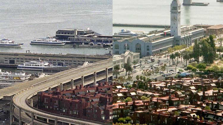
The double-deck Embarcadero Freeway (State Route 480) was damaged during the 1989 Loma Prieta earthquake and subsequently demolished, a decision that opened the eastern waterfront for redevelopment and public access. The removal of the elevated roadway led to the reconfiguration of the Embarcadero, the revitalization of the Ferry Building area, and long-term changes to San Francisco's waterfront planning and public space. The freeway's fall and the following redevelopment are commonly recounted in local urban lore about the city's post-earthquake transformation. The Embarcadero Center and Ferry Building area remain central, documented loci of that change.
Tags
Art / Graffiti Local Community Dams
Location
37.794815, -122.399697
Views
0

Comments

0
Be the first to comment!
Share
S
Locory name
Location details
Link to share
Link copied to clipboard
Report Locory
Locory

Discover, share, and explore community-driven points of interest with Locory.

Follow Us

About Contact Documentation Collaboration Upcoming Privacy Policy Terms of Service Accessibility Mailing List Wiki