Locory Every place has a story.
Login Sign Up
My Account
Open Map Create a Locory My Locories Featured Regions Leaderboard About What is a Locory? Collaboration Blog Feedback
Login Sign Up
My Account
  1. Home
  2. Mission Concepción - relocated 18th-century mission layout
Locory page

Mission Concepción - relocated 18th-century mission layout

By Seeker 6mo ago
See on map
Mission Concepción - relocated 18th-century mission layout photo 1
Mission Concepción - relocated 18th-century mission layout photo 2
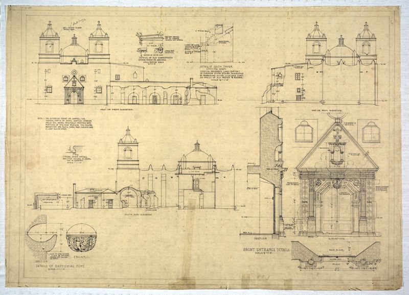
Mission Nuestra Señora de la Purísima Concepción de Acuña was relocated to its current San Antonio site in 1731 and its extant stone church dates to 1755. The mission’s church and surrounding lands were organized under Spanish colonial surveying practices, with documented boundaries and an associated acequia irrigation network used for mission agriculture. The site along the San Antonio River preserves an 18th-century mission-era surveyed layout that has been recorded in both archival and archaeological studies.
Tags
Maps & Surveying Missions Bridges Churches
Location
29.397424, -98.489156
Views
0

Comments

0
Be the first to comment!
Share
S
Locory name
Location details
Link to share
Link copied to clipboard
Report Locory
Locory

Discover, share, and explore community-driven points of interest with Locory.

Follow Us

About Contact Documentation Collaboration Upcoming Privacy Policy Terms of Service Accessibility Mailing List Wiki