Locory Every place has a story.
Login Sign Up
My Account
Open Map Create a Locory My Locories Featured Regions Leaderboard About What is a Locory? Collaboration Blog Feedback
Login Sign Up
My Account
  1. Home
  2. City–county consolidation creating a very large municipal area
Locory page

City–county consolidation creating a very large municipal area

By Seeker 6mo ago
See on map
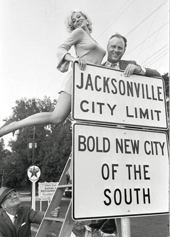
City–county consolidation creating a very large municipal area photo 1
City–county consolidation creating a very large municipal area photo 2
In 1968 Jacksonville and Duval County consolidated their governments, expanding the city's municipal boundaries to approximately 875 square miles and making Jacksonville the largest city by land area in the contiguous United States. The consolidated government is administered from Jacksonville City Hall and the arrangement left a few small incorporated municipalities (Atlantic Beach, Neptune Beach, Jacksonville Beach, and Baldwin) separate from the consolidated city. This political consolidation is a notable geographic and administrative anomaly among U.S. cities.
Tags
Government Maps & Surveying
Location
30.330078, -81.659018
Views
1

Comments

0
Be the first to comment!
Share
S
Locory name
Location details
Link to share
Link copied to clipboard
Report Locory
Locory

Discover, share, and explore community-driven points of interest with Locory.

Follow Us

About Contact Documentation Collaboration Upcoming Privacy Policy Terms of Service Accessibility Mailing List Wiki