Locory Every place has a story.
Login Sign Up
My Account
Open Map Create a Locory My Locories Featured Regions Leaderboard About What is a Locory? Collaboration Blog Feedback
Login Sign Up
My Account
  1. Home
  2. Doyers Street 'Bloody Angle' in Chinatown
Locory page

Doyers Street 'Bloody Angle' in Chinatown

By Seeker 6mo ago
See on map
Doyers Street 'Bloody Angle' in Chinatown photo 1
Doyers Street 'Bloody Angle' in Chinatown photo 2
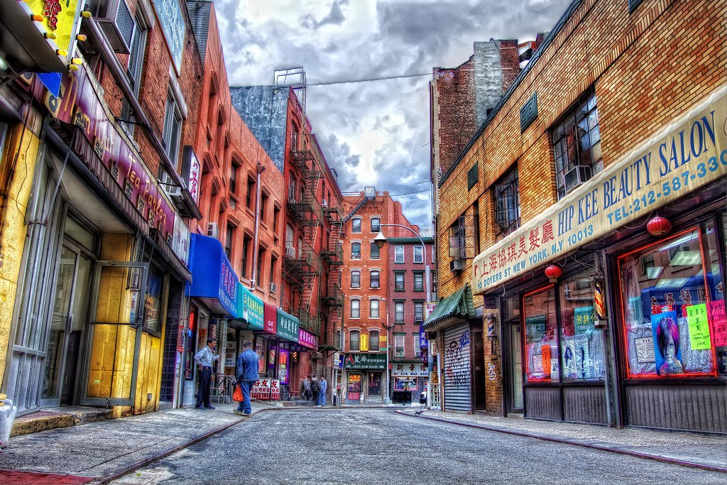
Doyers Street, a sharply curving one-block street in Manhattan's Chinatown, was historically known as the 'Bloody Angle' because of numerous violent confrontations and gang killings-particularly during early 20th‑century Tong wars-documented in contemporary newspapers and later histories of the neighborhood. The street's geometry (a narrow bend) and its concentration of social and commercial activity contributed to its reputation in local lore. References to the 'Bloody Angle' appear in scholarly works and local histories of New York's Chinese immigrant community. The street remains a notable historic feature of Chinatown's built environment.
Tags
Historical Art / Graffiti Local Community Murders Battles Local Lore
Location
40.714185, -73.997867
Views
0

Comments

0
Be the first to comment!
Share
S
Locory name
Location details
Link to share
Link copied to clipboard
Report Locory
Locory

Discover, share, and explore community-driven points of interest with Locory.

Follow Us

About Contact Documentation Collaboration Upcoming Privacy Policy Terms of Service Accessibility Mailing List Wiki