Locory page
Boumerdes and Algiers
By Seeker
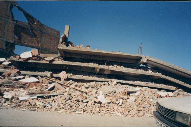
A destructive earthquake of magnitude Mw = 6.8 hit the region of Boumerdes and Algiers (Algeria) on May 21, 2003. This is among the strongest seismic events of the mediterranean region and the most important event in the capital Algiers since 1716. It caused a widespread damage in the epicentral region, claimed 2271 human lives, injured 10,000, about 20,000 housing units affected and left about 160,000 homeless. The main shock was felt about 250 km far from the epicenter and triggered sea waves of 1-3 m in amplitude in Balearic islands (Spain). The main shock was followed by many aftershocks among them several are of magnitude greater than 5.0, which added panic to inhabitants. The main shock triggered ground deformation, particularly liquefaction whose features are in different forms and sizes and caused damage and collapse of roads. The epicenter was located offshore about 7 km from the Boumerdes-Dellys coast.
Tags
Be the first to comment!