Locory page
Alexander Ralston's 1821 Mile Square plan
By Seeker
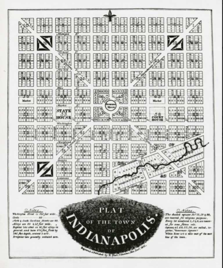
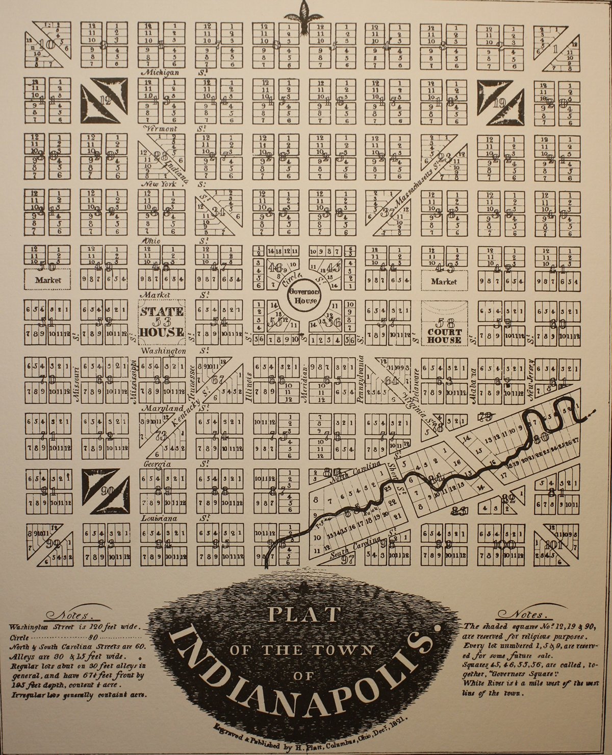
In 1821 surveyor Alexander Ralston, assisted by Elias Pym Fordham, laid out the original one-square-mile plat of Indianapolis known as the 'Mile Square.' Ralston based his design on Pierre L'Enfant's plan for Washington, D.C., using a rectilinear grid with diagonal avenues radiating to a central circular public space. That central circle later became the site for the Soldiers and Sailors Monument and served as the focal point of the early city plan. The original Mile Square boundaries defined the downtown core that remains the historic center of Indianapolis.
Tags
Location
Views
1
Be the first to comment!