Locory Every place has a story.
Login Sign Up
My Account
Open Map Create a Locory My Locories Featured Regions Leaderboard About What is a Locory? Collaboration Blog Feedback
Login Sign Up
My Account
  1. Home
  2. Precita Creek (buried beneath Precita Park)
Locory page

Precita Creek (buried beneath Precita Park)

By Seeker 6mo ago
See on map
Precita Creek (buried beneath Precita Park) photo 1
Precita Creek (buried beneath Precita Park) photo 2
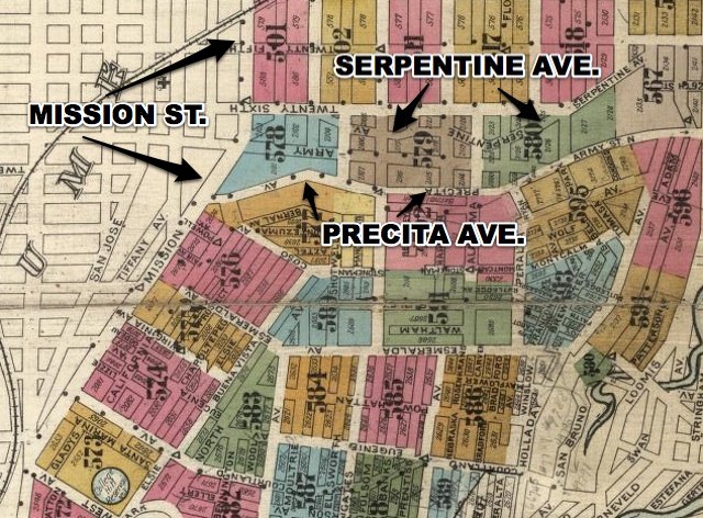
Precita Creek was a natural stream that flowed from Bernal Heights through the Mission District toward Mission Bay. During the late 19th and early 20th centuries the creek was filled and put into culverts and storm drains as the neighborhood developed. Precita Park and Precita Avenue lie over portions of the creek’s former channel, and buried storm infrastructure follows the old course beneath the streets.
Tags
Natural Wonders Local Community Buried Underground Storm Drains Battles Missions Old Infrastructure
Location
37.746711, -122.413074
Views
1

Comments

0
Be the first to comment!
Share
S
Locory name
Location details
Link to share
Link copied to clipboard
Report Locory
Locory

Discover, share, and explore community-driven points of interest with Locory.

Follow Us

About Contact Documentation Collaboration Upcoming Privacy Policy Terms of Service Accessibility Mailing List Wiki