Locory Every place has a story.
Login Sign Up
My Account
Open Map Create a Locory My Locories Featured Regions Leaderboard About What is a Locory? Collaboration Blog Feedback
Login Sign Up
My Account
  1. Home
  2. The Freedom Trail - 2.5-mile route linking 16 historic sites
Locory page

The Freedom Trail - 2.5-mile route linking 16 historic sites

By Seeker 6mo ago
See on map
The Freedom Trail - 2.5-mile route linking 16 historic sites photo 1
The Freedom Trail - 2.5-mile route linking 16 historic sites photo 2
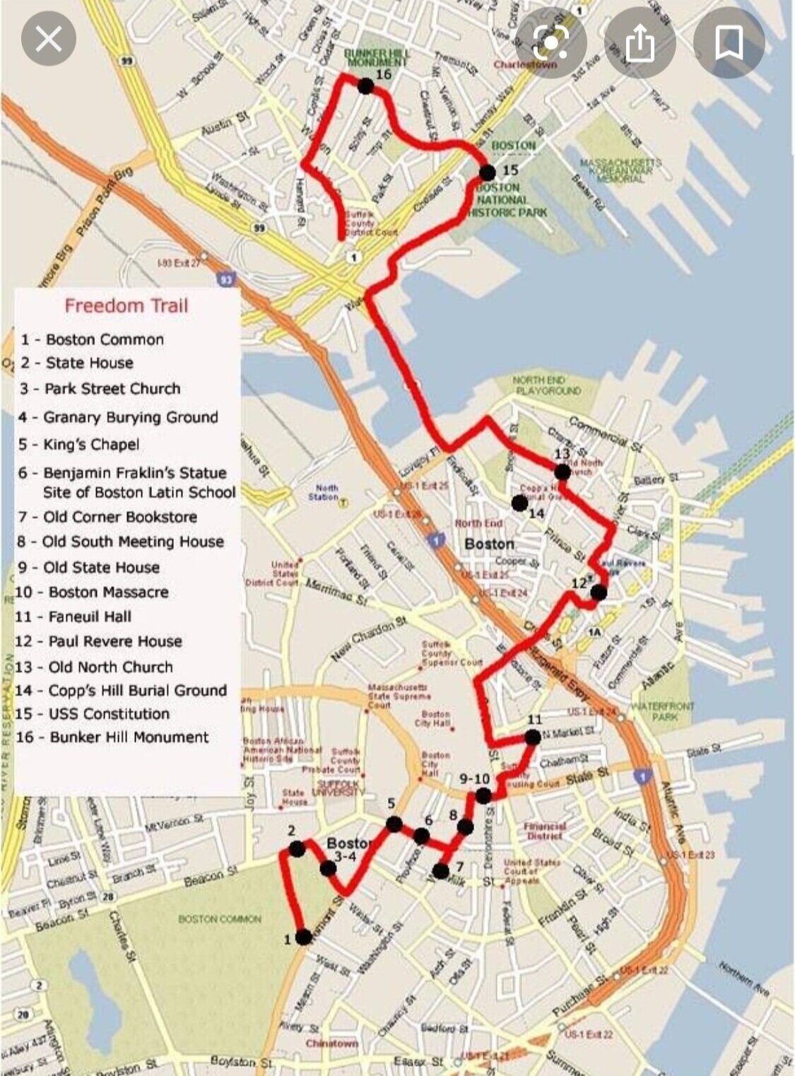
The Freedom Trail is a 2.5-mile marked route through downtown Boston that connects 16 nationally and locally significant historic sites, including the Massachusetts State House, Paul Revere House, Old North Church, and Bunker Hill Monument. A red-brick line in sidewalks and streets guides visitors along the route and the Trail is interpreted by the Freedom Trail Foundation and National Park Service partners. The Trail begins at Boston Common and is one of the city's most-visited historic experiences.
Tags
Historical Art / Graffiti Local Community Historic Landmarks Old Bunkers Churches
Location
42.355820, -71.062581
Views
0

Comments

0
Be the first to comment!
Share
S
Locory name
Location details
Link to share
Link copied to clipboard
Report Locory
Locory

Discover, share, and explore community-driven points of interest with Locory.

Follow Us

About Contact Documentation Collaboration Upcoming Privacy Policy Terms of Service Accessibility Mailing List Wiki